Radar Data Analysis
MDR Radar Summary Display
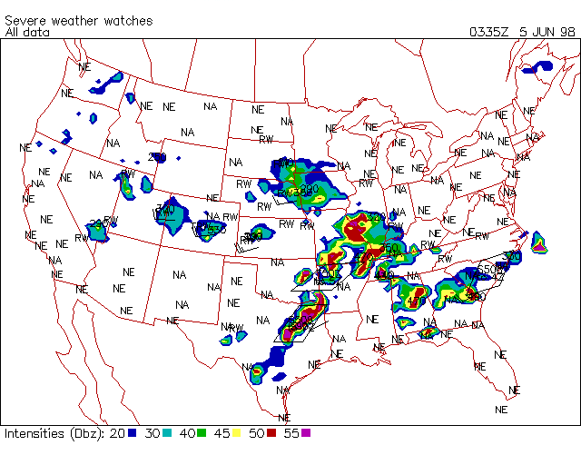
Radar summary data may be displayed using the rad program. This program will read either an hourly raw file or decoded MDR file and display the manually digitized radar summary report. The radar summary plot may be annotated with various pieces of information such as precipitation type, trend, echo tops, cell movement and severe weather watch boxes (see below).
These radar data estimate the intensity of radar echoes inside a grid box 48 kilometers on a side. The grid is a fourth of the LFM (Limited Fine Mesh prediction model) grid. The echo values representing the highest echo value in the box are ranked on a scale of one to six. Since the intensity of precipitation reported within a MDR radar grid box is the maximum intensity within that box and not an average precipitation intensity, precipitation coverage is often overestimated, especially in cases of convective precipitation.
| Intensity | DBz | Color | Precip Intensity | Approx.Rainfall Rate (inches/hour) | |
| Stratiform | Convective | ||||
|---|---|---|---|---|---|
| 1 | 20-30 | Blue/DGreen | "-" -- Light | 0.0 to 0.1 |
0.0 to 0.2 |
| 2 | 30-40 | Cyan/Green | "" -- Moderate | 0.1 to 0.5 |
0.2 to 1.1 |
| 3 | 40-45 | Green/LGreen | "+" -- Heavy | 0.5 to 1.0 |
1.1 to 2.2 |
| 4 | 45-50 | Yellow/Yellow | "++" -- Very Heavy | 2.2 to 4.5 |
|
| 5 | 50-55 | Red/Orange | "x" -- Intense | 4.5 to 7.1 |
|
| 6 | >55 | Magenta/Red | "xx" -- Extreme | > 7.1 |
|
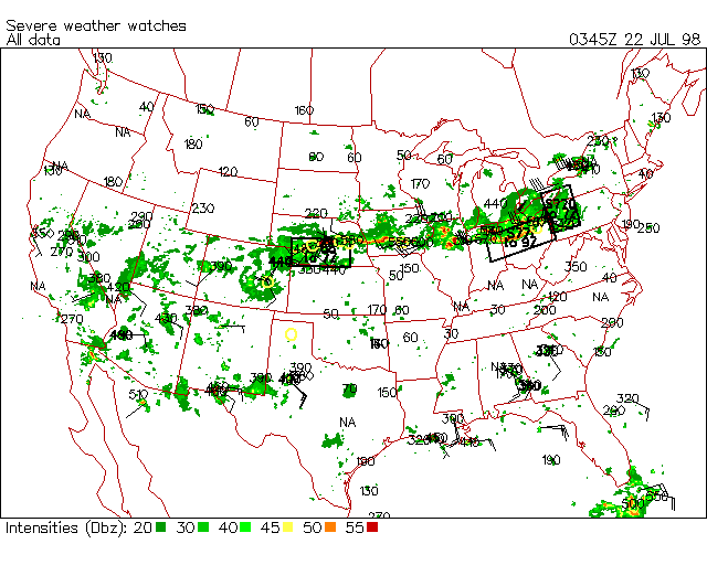
Annotation of the radar summary is available to display other pieces of MDR information. Most information such as precipitation type and intensity is plotted at the radar location. The maximum echo top information is plotted at the location of the top. The watch box information is plotted as a box representing the actual location of the watch area. Inside the box is the watch number and type "T567" or "S568" and expiration time "08Z".
NOTE: The locations for the watches are derived from the "sao_all.cty" city database file. Some stations may not be listed in that database and therefore the box may not display. If this is the case, the program will display a warning message and the user may add the station into this database file.
rad -cu=la -re=us -va=all -de=d
RCM Radar Summary Display
RCM (Radar Coded Messages) are similar to the MDR reports. RCM data is on a grid 1/4th the size of the MDR grid or roughly 12km resolution. RCM summaries are generated from the individual site RCMs using the radcvt program and are displayed using the rad program. The rad program can read in and display individual RCM site data or display the national summary. The radar summary plot may be annotated with various pieces of information such as storm ID, echo tops, movement, hail, TVS (Tornado Vortex Signatures), mesocyclone location, and severe weather watch boxes (see MDR above).
These radar data estimate the intensity of radar echoes with the same 6 levels as does the MDR data (see above).
rad -if=rcm_cvt -cu=la -re=us -va=comp -pp=numplt=1 -de=d
NIDS (Nexrad) Radar Display
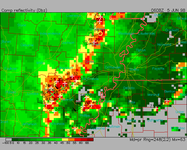
The NIDS data feed provides roughly 20 radar products sent every 5 minutes from each site. These products include base reflectivity and velocity, composite reflectivity, precipitation estimates, echo tops and VAD winds. The rad program will display the products a projection based on the radar site and range of data unless the plot domain is changed. Most products include 16 levels of data that have a default color fill table associated with them. The composite reflectivity product includes a storm attributes table that can be added to the plot (see below).
| Type | Description |
| Red triangle | Tornado Vortex Signature (TVS) |
| Yellow circle | Mesocyclone |
| Green * | > 75% Hail |
| Green x | > 50% Hail |
| Wind barb | Cell movement |
| Text UL | Storm ID |
| Text UR | Echo tops |
rad -na=nids -dp=/wxp/data/nids 9806050608.cref -va=comp
VAD winds plot as a time cross-section of wind barbs which are color coded showing a level of wind gusts (RMS speed deviation).
Radar Mosaics (NOWRad and Unisys)
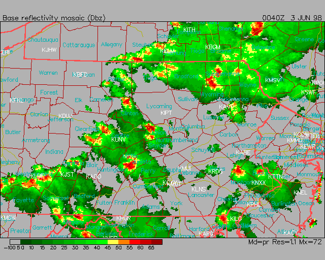
The rad program handles two type of radar mosaics:
- WSI's NOWRad -- 2 and 8 km base reflectivity mosaic (16 level) which covers the contiguous US.
- Unisys Mosaics -- 2, 4 and 8 km mosaics of reflectivity, tops and precipitation (8 and 16 level). The coverage includes the contiguous US.
The rad program will display these products either on their original projection (no plot domain specified) or remapped to the requested plot domain.
rad -if=nids -dp=/wxp/data/rad_mosaic -ct=radar.clr -cof=nowrad.cfl
-mf=fi:map_county -re=41,-77,.25 -cu=la
RRWDS Radar Site Display (Obsolete)
The rad program will also display Remote Radar Weather Display Systems (RRWDS). This option will take directionally scanned radar echo information from a single radar site and display it on a background map.
Last updated June 6, 1998


